| Environment and development in coastal regions and in small islands |
| Environment and development in coastal regions and in small islands |
Coastal
management sourcebooks 1
Case 1
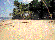
Countering the effects of high seas in winter
There are several natural forces that cause beach changes; these include: waves, tides and ocean currents. Waves are formed when the wind blows over the sea surface and the wind's energy is transferred to the water. As waves move towards the shoreline, they break and the turbulent energy stirs up and moves the beach sand. The higher the waves, the more energy is available for sand movement.
| Waves are the most significant force affecting beaches. |
Tides are another factor influencing beaches. (Tides are the periodic rising and falling of large bodies of water resulting from the gravitational pull of the moon and sun on the rotating earth.) There are usually two high tides and two low tides every day in the Caribbean islands, with about six hours between high tide and low tide. The average tidal range is low, around 0.3 m (1 ft). Tides generate currents, which flow in one direction as the tide is rising and in the opposite direction as the tide is falling. These tidal currents can move sand. Tidal currents are particularly significant in the passages between islands and at river mouths. (See also Case 9.) Ocean currents also help to shape coastal areas. These continuous flows of water in the ocean are controlled by the prevailing wind patterns. The North Equatorial Current flows in a west-northwest direction through the eastern Caribbean islands.
| Ocean and tidal currents move sediment on the djacent coastal shelf. |
The Caribbean islands lie within the Northeast Trade Wind zone. Waves are generally highest from June to July and from December to March when the wind speeds are highest. Wave direction varies according to the time of year. In the eastern Caribbean islands, waves approach from a predominantly easterly direction. For this reason, the waves are highest on the east or windward coasts where average wave height is more than 1 m (3 ft). On the leeward coasts, average wave height is usually less than 0.3 m (1 ft). Wave energy is concentrated at headlands and spread out in bays. This is a result of wave refraction, a process which results in the wave fronts being ‘bent’ as they approach the shore.
| The Northeast Trade Winds approach with great constancy from the northeast, east and southeast. The speed and specific direction, however, vary throughout the year. |
Most of the islands from Grenada to Saint Martin have longer east- and west-facing coastlines. The east is the windward coast and the west the leeward coast. However, the Greater Antilles (Cuba, Hispaniola, Jamaica and Puerto Rico), several of the Virgin Islands and the Bahamas have longer north- and south-facing coastlines. Here, the windward/leeward distinction is not so clear.
Waves formed where the wind is blowing are often irregular and are called wind waves. As these waves move away from the area where the wind is blowing, they sort themselves out into groups with similar speeds and form a regular pattern known as swell. Swell waves are most often experienced in the Caribbean between the months of October and April. They are usually caused by intense mid-latitude storms in the North Atlantic Ocean. (See Figure 3.) Swell waves travel thousands of kilometres south to affect the west, north and east coasts of the islands. Thus, severe storms in the North Atlantic Ocean, like those off the coast of Canada and the eastern USA, may indirectly affect the Caribbean through these swell waves.
| Swell waves cause serious beach erosion during the winter months. |
| Figure 3. Origin of swell waves affecting
the Caribbean islands. Waves travel south as swell to affect the Caribbean islands in the winter months and often cause serious beach erosion (Bacon, 1978). |
 |
As a result of swell, large waves may be seen breaking on the coast even on calm, sunny days in winter. (Swell waves are also generated by hurricanes; see also Case 2.) During each winter season, there may be from five to ten swell events, each lasting from one to eight days. Research has also shown that intense winter swell activity often runs in cycles, several active years being followed by several less active years (Deane et al., 1973). These swells are known locally by a variety of names, for example as groundseas. The height of swell waves on a usually calm leeward coast may vary between 1 m and 3 m (3–10 ft), although occasionally they may be as high as 5 m (16 ft).
In the Greater Antilles, the Virgin Islands, the Bahamas chain and the northern Leeward Islands, swell waves may also be generated by frontal systems moving across the southern part of the USA during winter. These systems generate waves from a westerly, northwesterly and northerly direction.
During swell wave conditions, leeward coasts in particular experience considerable erosion. (These leeward coasts usually experience fairly calm conditions.) Sand is moved offshore and trees and walls are undermined, leaving their roots or foundations exposed. (See Figure 4.) Swell waves may also cause changes in the shape of a beach by moving sand from one end to the other.
| Together with Trade Wind waves, winter swells are responsible for most of the seasonal changes seen on Caribbean beaches |
| Figure 4. Seasonal beach changes. During the summer, there is a wide beach protecting the dune and the building. This is eroded during the winter leaving the dune and building vulnerable to direct wave action (adapted from Bush et al., 1995). |
 |
During the summer months, when the seas are calmer and the waves smaller, beaches tend to build up. This process is known as accretion. Obviously, exceptions occur when a hurricane passes over or close to an island. The hurricane season lasts from June to November.
| Beaches tend to erode during the winter months and build up (or accrete) during the summer months, although this is not always the case. |
If the amount of winter erosion exceeds summer accretion, there is overall erosion with the land behind the beach being eroded as the beach retreats inland. The rate of retreat is called the erosion rate. Overall erosion may be due to one or more factors, for example: a particularly severe winter swell, a recent hurricane, the death of an adjacent coral reef or interference in the supply of sand.
Conversely, if accretion exceeds erosion, the beach gets wider over time and accretionary features, such as cuspate forelands, tombolos, spits and bars, may develop. (See Figure 5.)
| Figure 5. Accretionary coastal features.
These features are formed when sand is deposited by waves moving sand along the coast, a process known as longshore transport. See also Figure 16 (adapted from Komar, 1976). |
 |
P R A C T I C A L
R E S P O N S E S
Seasonal changes are inevitable, so human activities must be adapted accordingly.
Be aware that seasonal changes are natural occurrences. They cannot be prevented, so it is necessary to learn to live with them. Also, changes in one year may be much more severe than in the previous year.
View winter and summer beach conditions before contemplating the purchase of beachfront property.
If purchasing beachfront property, visit the site several times in both winter and summer before completing the purchase. If this is not possible, talk to neighbours about their observations of seasonal changes to the beach. Ask if they have photographs. Also consult local planning and environmental agencies, who may have information on beach changes.
| If you own beachfront property and are concerned, about seasonal changes occurring, you can take some simple measurements on a regular basis to assess whether a problem exists. |
Measure the beach changes.
Measure the distance from a fixed point, such as a wall or tree, to the high water mark once a week with a tape measure.
 |
| Photograph 5. Measuring
beach changes. The observers are measuring the distance between the vegetation line and the high water mark. |
Table 1 shows how measurements can be used to assess whether a problem exists. Take photographs of the beach from a fixed point during good (summer) conditions and bad (winter) conditions and compare these photographs over the years.
TABLE 1
Sample measurements of beach width
| A | Average the measured distances for each month and enter values in the table. | ||||
| TABLE OF BEACH WIDTHS IN 1993 | |||||
| Month | Distance to high water mark (metres) | ||||
| J a n u a r y | 1 5 . 5 | ||||
| F e b r u a r y | 1 0 . 2 | ||||
| M a r c h | 1 3 . 7 | ||||
| A p r i l | 1 4 . 0 | ||||
| M a y | 1 4 . 2 | ||||
| J u n e | 1 5 . 0 | ||||
| J u l y | 1 6 . 0 | ||||
| A u g u s t | 1 8 . 5 | ||||
| S e p t e m b e r | 1 7 . 0 | ||||
| O c t o b e r | 1 6 . 0 | ||||
| N o v e m b e r | 1 4 . 4 | ||||
| D e c e m b e r | 1 3 . 2 | ||||
| B | Calculate the average winter and summer values. | ||||
|
|||||
| C | Compare the winter and summer values for successive years | ||||
| YEAR | AVERAGE W i n t e r Distance (m) | AVERAGE S u m m e r Distance (m) | MINIMUM DISTANCE (m) | MAXIMUM DISTANCE (m) | |
| 1 9 9 3 | 1 3 . 9 | 1 6 . 1 | 1 0 . 2 | 1 8 . 5 | |
| 1 9 9 4 | 1 3 . 5 | 1 7 . 0 | 9 . 0 | 2 1 . 0 | |
| 1 9 9 5 | 1 4 . 2 | 1 5 . 3 | 1 1 . 9 | 1 8 . 2 | |
| 1 9 9 6 | 8 . 2 | 1 6 . 4 | 6 . 0 | 1 5 . 8 | |
|
|||||
Obtain advice and permission from planning agencies.
If, during seasonal erosion in winter, your land or property is being seriously eroded, you may wish to try to stabilize the shoreline or your property boundary. The decision as to what to do is a difficult one and needs careful consideration. It may involve both your property and that of your neighbours.
| It is important to consider the effects of your actions on neighbouring properties. |
Implement measures during the summer when wave conditions are calmer.
The timing for suitable responses is also important. It is much harder and more expensive to build a structure when the waves are actually undermining the building. In other words, do not wait until the situation has turned into a dire emergency.
| Act before an emergency situation develops. |
Set new buildings well back from the beach.
If your beachfront land has not yet been built on, you may wish to consider setting your buildings farther back from the sea than initially planned. You would thus help to conserve the beach in a natural state without having to build expensive, unsightly sea defences. The beach will also protect your property. Consult your planning agency for more information about recommended building setbacks. (See also Chapter 2 for more information on coastal development setbacks for buildings and how they may be calculated.)
| All shoreline protection measures must be carefully designed and permits obtained from the planning authorities before construction starts. |
Consider the sea defence options.
If buildings are already in place and being threatened by erosion, you may wish to protect your property. The various options described on the following pages fall into two main categories:
| Figure 6. Structures to protect coastal
land and property. These structures, while protecting the land, do not usually promote beach build-up (adapted from US Army Corps of Engineers, 1981 and Bush et al., 1995). |
Seawalls |
Bulkheads |
Rock
revetments |
Consider measures which protect the land, but which do not promote beach build-up.
Seawalls are massive structures made of steel, rock or concrete. They have a curved or vertical seaward face and are designed to protect land and buildings from the impact of the waves.
Bulkheads are similar to seawalls. They have vertical seaward faces and are designed to protect land from slumping and eroding into the sea. They are most suitable for quiet water areas like lagoons.
Rock revetments consist of armour rocks placed against a sloping face.
Structures with a vertical seaward face, such as seawalls and bulkheads, reflect wave energy and augment wave turbulence. This results in the water cutting downwards below the base of the structure and digging out the sand, a process known as wave scour. On the other hand, a sloping rock revetment absorbs much of the wave energy. It is important to understand the consequences of building structures which protect the land or property only. While these structures may protect the land, they do not promote the deposition of sand.
| As erosion continues, the beaches in front of seawalls or revetments become narrower and, in some cases, disappear altogether. |
Seawalls, bulkheads, revetments and the like may also affect neighbouring properties, so often a community approach is recommended. (See also Case 4 and Figures 14 and 15.) Gabions, which consist of stones in wire baskets, are often used as materials to construct walls, bulkheads, revetments and sometimes ‘mattresses’ extending under the beach in the Caribbean. (See Figure 7.)
| Figure 7. Slope stabilization using
gabions. The stones have to be closely packed in the wire baskets so as to reduce their movement (adapted from US Army Corps of Engineers, 1981b ). |
 |
The wire enclosing the gabion basket is coated with plastic. However, without regular maintenance, water action results in the stones rubbing against each other and wearing away the plastic-coated wire, leaving the stones to spill over the beach. Gabions are best for slope or channel stabilization where there is no danger of waves reaching them frequently.
Consider measures which protect the land by promoting beach build-up.
Groynes and offshore breakwaters are hard structures; the former is designed to trap sediment and the latter to protect the shore from wave action. These are described in greater detail in Case 4. As for beach nourishment, it consists of adding sand to the beach, usually from an offshore source. (See also Case 5.) Generally, such measures are not carried out by individuals working alone because they are very expensive and affect entire beaches. They require the co-operation of all land owners along a particular beach or coastal stretch.


