
Natural Sciences
Africa & Arab States
Algeria
- � UNESCO/Pittet, Pierre A
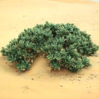
- Drought talah, spontaneous flora
The country is covered by the UNESCO Office in Rabat, Morocco.
Because of its proximity to the Mediterranean, its varied topography, and its vulnerability to earthquakes, the country has a vested interest in the earth sciences. It is also over-dependent on groundwater resources, which account for some 60% of its total water withdrawals.
Below you can access the projects that are currently being implemented in Algeria within the framework of UNESCO�s Natural Sciences Sector.
Freshwater
- Water Programme for Africa, Arid and Water Scarce Zones (WPA)
- Alpine and Mediterranean Flow Regimes from International Experimental and Network Data (AMHY FRIEND)
People, Biodiversity and Ecology
- Global change and mountain regions (GLOCHAMORE)
- Biosphere Reserves (WNBRs)
Oceans
- Global Ocean Observing System (GOOS)
- OceanData and Information Network for Africa (ODINAFRICA)
Earth Sciences
- Pan-African Network for a Geoscience Information System (PANGIS)
- The boundaries of the West African craton (IGCP, Project 485)
- Geodynamics of the East African Rift System/Geophysical Characteristics and Evolution of the South-western Branch of the East African Rift System (IGCP, Project 482/489)
- Ordovician palaeogeography and palaeoclimate (International Geosciences Programme (IGCP, Project 503)
- Coastal vulnerability related to sea level change (IGCP, Project 515)
- Black Sea-Mediterranean Corridor during the last 30,000 years: Sea level change and human adaptation (IGCP, Project 521)
Natural Disaster Reduction
- Reducing Earthquake Losses in the Eastern Mediterranean Region (RELEMR) programme
- Programme for the Assessment and Mitigation of Earthquake Risk in the Arab Region (PAMERAR)