


Using technology to fortify ASEAN against floods
Third ASEAN Academic Network Technical Training Workshop for Water and Disaster Management held as extreme weather events related to water on rise in sub-region
Devastating flooding across 12 provinces in Southern Thailand early last month during what is typically the dry season killed more than 90 people, affecting some 1.8 million people – almost 600,000 families. According to Thailand’s Department of Disaster Prevention and Mitigation, the unexpected flooding damaged 314 roads, 348 bridges, 270 drains, 126 weirs, two reservoirs, 70 government offices and 2,336 schools.
The floods are further proof that natural disasters are getting increasingly severe as climate change advances, and they underscore the urgent need for improved water resources management and disaster risk reduction.
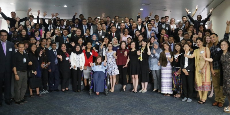
Scientists and policy-makers from ASEAN member states gathered in Bangkok for a timely meeting to promote capacity building in using satellite-based rainfall estimation products to plan for and manage water-related natural disasters as well as to strengthen research collaboration through the ASEAN academic network.
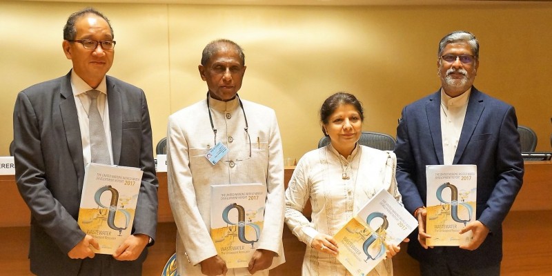
The third ASEAN technical workshop on “CHRS [Centre for Hydrometeorology & Remote Sensing] Remote Sensing Precipitation and Bias Adjustment of PERSIANN-CCS [Precipitation Estimation from Remotely Sensed Information using Artificial Neural Networks Cloud Classification System] Estimation for Water and Disaster Management” was held from 24-26 January. The workshop, organized by UNESCO and the UNESCO Chair in Water Disaster Management and Climate Change (Faculty of Engineering at Chulalongkorn University), was attended by 53 participants (15 women and 38 men) from Cambodia, Indonesia, Lao PDR, Malaysia, Philippines, Thailand and Viet Nam.
Two experts from the CHRS at the University of California, Irvine, joined the workshop for hands-on training in the use of PERSIANN-CCS, a satellite-based software product that offers near real-time (within 30 minutes) precipitation estimates, with a high spatial resolution (four kilometres), enabling users to visualize hourly precipitation accumulation.
On the first day of the training, Professor Kuo-Lin Hsu from the CHRS presented PERSIANN-CCS and PERSIANN-Climate Data Record (PERSIANN-CDR), which provides rainfall data from 1983 to close to the present day.
The floods in Southern Thailand were used to demonstrate the capabilities of the PERSIANN-CCS system, with an animation showing how the system tracked hourly accumulations of clouds around that time.
Professor Phu Nguyen from the CHRS demonstrated CHRS RainSphere, the desktop version of iRain (see box) and the CHRS Data Portal. Precipitation data, such as average precipitation by month and year from 1983 by country and region, can be found through CHRS RainSphere and all PERSIANN products through the CHRS Data Portal. A technical session followed on bias adjustment of satellite-based precipitation estimation using gauge observation.
The following days of the workshop incorporated Q&A and feedback sessions, with suggestions including potential future workshops on drought analysis and monitoring using PERSIANN-CDR. Participants also presented regional research on climate change and uncertainty in hydrology and meteorology, disaster management as well as satellite-based rainfall applications.
The workshop was proposed by UNESCO under the International Hydrological Programme (IHP)’s Global Network on Water and Development Information for Arid Land (G-WADI).

The first ASEAN Academic Network Technical Training Workshop.
www.unescobkk.org/news/article/regional-experts-target-catastrophes-due-to-climate-change/
The second ASEAN Academic Network Technical Training Workshop: www.unescobkk.org/news/article/asean-disaster-prevention-efforts-stepped-up-with-satellite-systems-training/
G-WADI: www.gwadi.org
CHRS RainSphere: rainsphere.eng.uci.edu
CHRS Data Portal: chrsdata.eng.uci.edu
iRain: Citizen monitoring of climate’s impact on water cycle
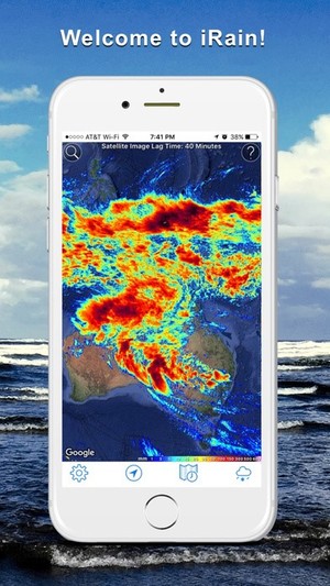 |
Accurate and timely information is essential to water resource planning and preparing for floods and droughts. An app launched late last year at the UN Climate Change Conference (COP22) by UNESCO’s International Hydrological Programme and CHRS invites people from around the world to contribute toward this important goal iRain, available for iOS and Android, allows users to not only visualize global satellite precipitation observations and track extreme precipitation events but also to contribute to the accuracy of the information provided by supplementing the data with their own local rainfall information. This crowd-sourcing functionality enables CHRS to compare local observations with satellite information, looking for disparities and making adjustments as needed. The app uses the PERSIANN algorithm as the basis for its data and real-time high resolution satellite precipitation readings from PERSIAN-CCS are available via the app. The app is part of a wider effort to engage non-scientists to collect data that can be used by local and national authorities to develop and fine-tune adaptation measures and better manage water resources. iRain (desktop version): irain.eng.uci.edu |