Article
Lake Chad: monitoring water quality through satellite Earth Observation

Good water quality in Lake Chad is vital for ecosystems’ integrity and for the health of local communities and the preservation of their traditional livelihood practices such as fishing, breeding and harvesting of spirulina, which depend on of this precious resource and its water quality. The UNESCO World Water Quality Portal for Lake Chad, thus supports ecological preservation, local livelihoods, sustainable development, and peace in the Lake Chad Basin, whose water and natural resources over 40 million people depend on.
The launch event counted with the participation of Ms Hajo Sani, Ambassador and Permanent Delegate of Nigeria to UNESCO; Mr Suleiman Hussein Adamu, Minister of Water Resources of Nigeria; Mr Hycinth Banseka, Technical Director, Lake Chad Basin Commission; Mr Vincent Castel, representative of the African Development Bank; and Ms Hindou Oumarou Ibrahim, Chairperson of the Association of Indigenous Fulani Women of Chad. Ms Shamila Nair-Bedouelle, Assistant Director-General for Natural Sciences of UNESCO, emphasized that the portal is a contribution to open science, by making the cutting-edge scientific innovation accessible to countries and local stakeholders.
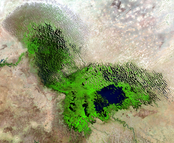
The Portal provides open access to data on water quality of Lake Chad and its tributary Chari-Logone rivers, since 2013, retrieved from EO images from Sentinel-2 and Landsat satellites and obtained from field measurements. Data on the evolution and changes of the Lake Chad water surface and water level are also available on the Portal through satellite Earth Observation images. Information on water quality is essential for sustainable water management and supports science-based decision making.
The Portal was conceptualized and developed under the International Initiative on Water Quality (IIWQ) of UNESCO’s Intergovernmental Hydrological Programme (IHP). Its application in the Lake Chad Basin was made possible through collaboration between IHP and the Man and the Biosphere (MAB) programme in the framework of the Project “Biosphere and Heritage of Lake Chad” (BIOPALT). The Portal launch took place during the 50th anniversary of the MAB Programme. The Portal for Lake Chad is the first application of the use of satellite EO data for operational monitoring of inland freshwater quality, building on the demonstration phase of the UNESCO World Water Quality Portal for selected river basins in world’s different regions in 2018.
More information:


