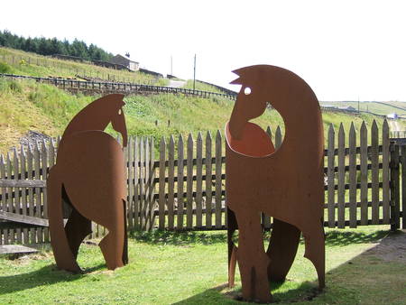
“Visitors can discover the world class lead mining heritage of the North Pennines”
Celebrating Earth Heritage
 The North Pennines AONB UNESCO Global Geopark is an upland area, in the north of England. It is a place of wild moors, remote hills, broad green valleys and scattered stone-built settlements. Stretching across large parts of the counties of County Durham, Northumberland and Cumbria, it is nationally designated as an Area of Outstanding Natural Beauty (AONB) an IUCN Category V Protected Landscape. It is famous for its birdlife, its arctic alpine flora and its sense of wildness and remoteness which is unrivalled in England. The world famous rivers the Tees, the Tyne and the Wear all rise in the North Pennines. The rocks and landscapes of the North Pennines have amazing stories to tell, of moving continents and tropical seas, of molten rock and ice sheets and of minerals and the men that mined them.
The character of this unique landscape has its foundation in the underlying rocks and has been 500 million years in the making. Layers of carboniferous limestone, shale and sandstone form terraced hillsides, and have provided stone for the area’s distinctive dry stone walls and villages. The famous Whin Sill, a 295-million-year old igneous intrusion, forms dramatic cliffs and spectacular waterfalls. Cutting through the rocks are veins of lead ore and other minerals and the North Pennines is perhaps most famous for the North Pennine Orefield and its world-class mineral riches.
Centuries of mining have left a rich heritage of ruins and spoil heaps, now colonised by unusual plants. During the last glaciation a thick ice sheet smoothed the landscape, creating glacial landforms and deposits. A thick blanket of peat, which formed on the uplands after the ice melted, is a special habitat and represents England’s most important peatland resource.
© Margarete Patzak
Sustaining local Communities
The North Pennines AONB UNESCO Global Geoparks uses its rich geological heritage to tell the story of the landscape and the way in which the rocks have influenced natural habitats and human settlement and activity over thousands of years. Visitors can explore this fascinating area through festivals, events, educational activities in and out of school, evening classes, walking and cycling trails (including through our electric bike network) and much more.
Related information
- Global Geopark Network Designated Year: 2004
- UNESCO Global Geopark Designated Year: 2015
- Localisation: N54°47’17”, W002°25’01”
- Area: 1,938 km2
Contact
- Tel.: +44 1388 528801
- E-mail: info@northpenninesaonb.org.uk
- Postal address: North Pennines AONB Partnership, Weardale Business Centre, The Old Co-op Building, 1 Martin Street, Stanhope, Bishop Auckland, County Durham, DL13 2UY, UK
- Website
Official representative
- Chris Woodley-Stewart, email: chris@northpenninesaonb.org.uk, tel.: +44 (0)1388 528801
