“Roof of Central China”
Celebrating Earth Heritage
 Located in the southwest part of Shennongjia Forestry District, Hubei Province, Shennongjia UNESCO Global Geopark is a Geopark that integrates tectonic geomorphology and mountain ecosystems. The UNESCO Global Geopark consists of five subareas: Shennongding, Guanmenshan, Tianyan, Dajiuhu and Laojunshan.
During its geological history of 1.9 billon years, Shennongjia experienced multiple tectonic movements, forming a very special alpine structural landform. Shennong Peak, with an altitude of 3,106.2 m, is the highest peak in central China. Shennongjia Group, a complete set of strata formed in the Mesoproterozoic, is an important geological heritage. The diabase dyke exposed in the UNESCO Global Geopark provides good evidence of the splitting of Rodinia supercontinent. The moraine conglomerate of Neoproterozoic Nantuo Formation is a relic of ancient global ice age. Widely distributed stromatolites are important evidence for research on prehistoric organic evolution and sedimentation environment. These geological relics, as well as cap dolomite of Doushantuo Formation of Sinian System, quaternary glacial landform and Dajiuhu wetland section are of great significance for the research on paleoclimate, paleogeography and geological evolution. Over 200 mountainous landforms, structural landform, fluvial landform, karst landform and glacial landform sites make the UNESCO Global Geopark a natural geo-museum.
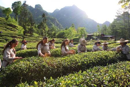
Sustaining local Communities
Shennongjia UNESCO Global Geopark has developed annual geo-science education plans, signed research & education partnership agreements and established research and education bases with universities and research institutes, designed 4 geo-education tour routes, installed over 3,000 geo-tour guide and interpretation boards, published 5 popular science books and 8 different kinds of brochures, and produced popular science posters, postcards and videos. Every year the UNESCO Global Geopark carries out popular science lectures, exhibitions and community promotion activities on the Earth Day, the Environment Day and in the Popular Science Week. The geo-museum within the UNESCO Global Geopark, which is open to the public for free, receives more than 200 thousand visitors per year.
The UNESCO Global Geopark receives over 1.5 million tourists annually, and benefits the local people by providing them many business opportunities and jobs, which greatly helps the sustainable development of the local economy, the community and the environment.
Related information
- Global Geopark Network Designated Year: 2013
- UNESCO Global Geopark Designated Year: 2015
- Localisation: N31°44'43'', E110°40'52''
- Area: 1022.72 km2
Contact
- Tel.:
- E-mail: snjdzgy@163.com
- Postal Address:
- Website
Official representative
- Chen Jinxin, email: snjdzgy@163.com, tel.: +86 719 3452238 or +86 13477999007