News
Preparing the groundwork for a network of geoparks in Africa
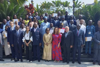
The Republic of Congo came a step closer towards setting up a geopark between 13 and 18 June when it was one of 14 African countries which sent delegates to a training course on geological heritage in the departments of Pointe-Noire and Kouilou. The 25 young geologists left the course vowing to inventory the geological heritage in their respective countries.
Blending theory with field visits, the trainers expounded on the concepts of geodiversity, geological heritage and geoconservation for the benefit of delegates who had come from the geological surveys of Algeria, Angola, Benin, Comoros, Cameroon, the Central African Republic, Republic of Congo, Democratic Republic of Congo, Djibouti, Côte d’Ivoire, Guinea, Niger, Nigeria, Togo and Senegal. Experts on geoheritage explained to the trainees how they defined geological heritage and classified this at the local, regional, national and international levels.
The course organizers are grateful to the Ministry of State and Minister of Mines and Geology, Pierre Oba, for his warm welcome of Africa delegates and his participation to this course.
The six-day course was part of PanAfGeo, an initiative co-funded by the European Union that has been supporting the training of geoscientific staff from African geological surveys since 2016 to increase African-owned geological knowledge and skills for sustainable mineral exploitation and related infrastructure, as well as natural disaster prevention and mitigation. PanAfGeo stands for Pan-African Support to the EuroGeoSurveys-Organisation of African Geological Surveys Partnership. This unprecedented pan-African project is led by the French Geological Survey, the Bureau de recherche géologiques et minières. The course was co-organised by the Polish, French and Spanish geological surveys in close cooperation with UNESCO. The course was hosted by the Ministry of Mining Industries and Geology.
To be part of the global network, a geopark must be of international significance
Dr Ozlem Adiyaman-Lopes from UNESCO explained the concept of ‘UNESCO Global Geopark’ to the trainees. There are currently hundreds of geoparks around the world. Of these, 177 in 46 countries belong to UNESCO’s network of global geoparks, a designation which recognises geological heritage of international significance.
UNESCO Global Geoparks must be single, unified geographical areas with a multitude of geological sites of international value contained within that same area. These sites offer an extraordinary geological diversity that also underpins the region’s biological and cultural diversity. Geoparks serve local communities by combining the conservation of their unique geological heritage with outreach to the public and sustainable development. They promote understanding of key issues, such as the need to use mineral resources sustainably, the impact of natural hazards and climate change and the empowerment of indigenous peoples.
Although the global geopark label is UNESCO’s most recent site designation, dating from 2015, the network already covers a surface area of 370,662 km², comparable to the size of Japan. However, the label is less well-known than UNESCO’s World Network of Biosphere Reserves, which dates from the 1970s and now counts 738 sites in 134 countries, and above all, UNESCO’s World Heritage List, which now counts 1,154 sites in 167 countries.
There are currently two global geoparks in Africa, the Ngorongoro Lengai UNESCO Global Geopark in Tanzania and M’Goun UNESCO Global Geopark in Morocco.
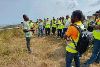
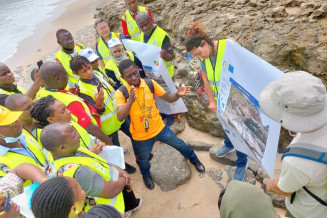
During the six-day course, participants studied several Congolese geological outcrops to evaluate their potential for being nominated as a geosite at local, national and international levels. These outcrops expose metamorphic rocks of up to two billion years in age, as well as sedimentary rocks which have formed within the past 250 million years, namely, the gorges of Diosso, the Djéno Rochers , Pointe-Indienne, the mouth of the Kouilou River (560 km in length), the Mayombe Chain and the Makola salt heap (terril salifère).
Participants in the course conducted an evaluation of the gorges of Diosso, formed over millions of years through a process of erosion that has created cliffs which descend to a depth of about 100 m. These cliffs reveal a succession of stratified sandy-clay deposits of variable thickness. These deposits would have been left by the recurrent flooding of an ancient river which could correspond to the current Kouilou River. Over time, this process of erosion has sculpted spectacular vertical rock formations which have been dubbed fairy chimneys.
A visit was also organized to a cultural heritage site of great significance, the slave route in Loango.
An opportunity to participate in the International Geosciences Programme
UNESCO not only administers the Global Geoparks Network. It also manages the International Geosciences Programme, which supports geological research and capacity building projects worldwide which have an international component, in partnership with the International Union of Geological Sciences. Dr Adiyaman-Lopes encouraged the young geologists present to participate in these international research projects and to identify potential geosites for future geoparks in their countries.
‘Through this programme’, said Abba Aji Abakar from Nigeria, ‘I learnt that geodiversity and geological heritage are to be taken into account as part of the management of all natural protected areas’. He observed that ‘African countries should begin to work tirelessly and have a legislative framework to carry out an inventory of geological heritage and ensure its proper conservation’.


