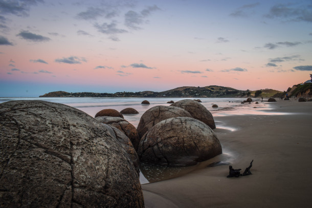
Waitaki Whitestone UNESCO Global Geopark

New Zealand’s first UNESCO Global Geopark lies on the east coast of the South Island, extending over an area of 7,214 km2 from the Waitaki Valley to the base of the Southern Alps. The landscapes, rivers and tides of this geopark have enormous cultural significance for the local indigenous people, the Ngāi Tahu whānui.
Ka titiro ake ki te tihi o Aoraki, Heke atu ki te awa tapu o Waitaki, Huri ki te Moana o Araiteuru, Tēnā koutou katoa
Celebrating Earth heritage
The geopark offers exceptional insights into the history of the Earth’s eighth continent, Zealandia, or Te Riu-a-Māui in Maori. The geopark provides evidence of the formation of Zealandia, which broke away from the ancient supercontinent of Gondwana around 80 million years ago. The continent then became submerged under the ocean for millions of years before tectonic forces thrust New Zealand above the waves and the country’s current mountain-building phase began. Today, about 94% of Zealandia remains submerged, stretching from east of New Zealand all the way north to New Caledonia.
Sustaining local communities
Shaped by volcanoes and glaciers, the district is bordered by the Waitaki River, an early super-highway for New Zealand's first people who left traces of their lives along its banks. In the 19th century a bustling town rose up, carved out of 'whitestone'. Written in the stone and in the earth is the story of the Waitaki - a geological wonderland, steeped in history and waiting to be explored.
The population of the Geopark is 22,300. Ōamaru is the largest town with a population of 13,715 and there are 16 towns and villages in the area. The Geopark offers a home for local wine and food producers, which is reflected in the emerging range of geogastronomy offerings available. Although the dominant business sector in the Waitaki area is agriculture, tourism is a significant and growing contributor to the local economy.
Contact
- Tel: +64 3 433 1607
- E-mail: manager@whitestonegeopark.nz
- Postal address: 20 Thames Street, Private Bag 50058, Oamaru, New Zealand 9400

